About Tinfoil Pigeons
Overview
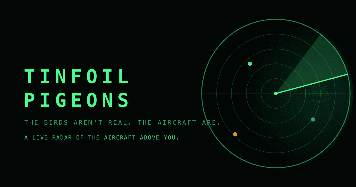
Tinfoil Pigeons is a browser-based live radar that shows the aircraft flying over any location in the world. You enter a postcode, town, or city, or share your location, and the site plots every ADS-B broadcast as a green blip on a glowing radar scope. Tap any blip and the scope locks a reticle and opens that aircraft's file.
The file lists aircraft type, operator, registration, altitude, speed, heading, and distance from your position. Military contacts, public service flights such as air ambulance, police, coastguard and search and rescue, aircraft in distress, and contacts that stop broadcasting each get their own marker on the dial.
Key Benefits
- Works from any postcode, town, or city on the planet, or from your device's GPS location.
- Identifies overhead aircraft inside the browser with no app install, account, or payment.
- Separates military contacts and blue-marked public service flights from ordinary traffic.
- Flags aircraft in distress and draws signal-lost contacts coasting at their last known position.
- Lets you switch the scope between 10, 25, 50, and 100 nautical mile ranges and 4, 8, or 12 second sweeps.
- States that it stores neither your postcode nor your GPS location.
How It Works
Enter a postcode or place, or tap Use My Location, and the scope centres on you as the pulsing dot in the middle of the dial. The sweep redraws each aircraft's position every few seconds, and any blip inside the first ring sits overhead right now. Tap a contact to read its type, operator, and registration, then tune range, sweep speed, units and labels from the side panel, or pop the scope out into its own window for a wider view.
Use Cases
- Plane spotters pick their local range and tap blips to log registrations and aircraft types overhead.
- Homeowners who hear engine noise check the middle of the dial to see what is passing over the roof.
- Aviation enthusiasts switch on the MIL highlight to follow military traffic without hiding it from the scope.
- Incident watchers trace coastguard, police, and search and rescue flights marked in blue during an operation.
- Privacy-minded visitors look up overhead traffic without creating an account or handing over a stored location.
Why Choose This Product
Tinfoil Pigeons renders live flight data as a cathode ray radar rather than a flat map, so the overhead picture reads at a glance. It separates military, public service, distress, and signal-lost contacts so you can tell an airliner from an air ambulance without scanning a list. The site asks for no account and says it keeps neither your postcode nor your location.
Tinfoil Pigeons Pros & Cons
- Free to use with no app, account, or payment required
- Covers any postcode, town, or city worldwide plus GPS location
- Tap panel shows type, operator, registration, altitude, and speed
- Markers for military, public service, distress, and signal-lost contacts
- Site states postcode and GPS searches are not stored
- Unscheduled flights show no origin or destination because ADS-B does not broadcast a route
Key Features
Live ADS-B Scope
The scope plots every aircraft broadcasting ADS-B position over your chosen location and redraws them sweep after sweep.
Postcode or GPS
You centre the radar by typing a postcode, town, or city anywhere in the world or by tapping Use My Location.
Tap-to-Identify Files
Tapping a blip locks a reticle and opens the aircraft's type, operator, registration, altitude, speed, heading, and distance from you.
Military Highlight
The MIL highlight toggle marks military contacts with a diamond while leaving them visible on the scope.
Public Service Layer
Air ambulance, police, coastguard, and search and rescue aircraft show in blue, and a toggle hides them entirely.
Range and Sweep
You set the dial to 10, 25, 50, or 100 nautical miles and choose a 4, 8, or 12 second sweep.
Sonar Ping
The scope emits a soft blip when a new aircraft enters the dial.
Signal-Lost Coasting
Contacts that stop broadcasting appear as an open circle coasting at their last known position.
Unit Switching
A toggle switches between kilometres, metres and km/h or nautical miles, feet and knots.
Pop-Out Scope
You can pop the scope into its own window for a larger radar view.
Frequently asked questions about Tinfoil Pigeons
What plane is flying over my house right now?
Enter your postcode or town, or tap Use My Location, and look at the middle of the dial. You are the pulsing dot, and anything inside the first ring is overhead. Tap a blip to see its type, operator, and registration.
How does Tinfoil Pigeons know where aircraft are?
Aircraft transponders broadcast position, altitude, and identity over ADS-B. A worldwide network of enthusiasts with aerials picks up those signals, and the site draws them on a radar-style scope.
Why does a flight have no route?
ADS-B does not broadcast origin or destination, and route databases only know scheduled flights. Private jets, trainers, helicopters, and military aircraft often have no flight plan on file, which the site calls mystery pigeons.
Is using Tinfoil Pigeons legal?
The site says yes: the data comes from public radio broadcasts that plane-spotters with scanners have logged since the seventies.
Do I need an app or an account?
No. The site runs in the browser with no app, no account, and no charge.
Does Tinfoil Pigeons store my location?
The site states that it keeps neither your postcode nor your GPS location.